Hiking the Grand Canyon From Rim to Rim in One Day
Our Thrilling Journey Through the Grand Canyon
In the summer of 2018, my wife Abigail asked me if I would accept the challenge of hiking the Grand Canyon from rim to rim. We had been to the Canyon several times, and even completed an overnight backpacking trip to the Bright Angel campground and back in 2011. That adventure was 17 miles round trip, all the way down to the Colorado River and back. It was the toughest, most physically strenuous, and most mentally challenging thing I had ever done. This would be tougher, much tougher. But, I was all in, and replied “Hell yeah!”.
I spent numerous hours researching the trip, what to expect, how much food and water to bring, what supplies are recommended, etc. The hike is about 25 miles from rim to rim. We decided to hike from the North rim to the South, in which we would descend 6,000 vertical feet to the Colorado River over about 15 miles, and then ascend 5,000 vertical feet over the remaining 10 miles. This was the easier route – 1,000 fewer verticle feet to climb, and hiking up the Bright Angel Trail along the South rim is safer. There are rest houses with emergency phones, more hiker traffic, and more presence from the park rangers. It turns out we made the right decision – more on that later.
In the summer of 2018, I started to book our accommodations for the trip, but the North Rim Lodge was booked solid through the end of 2019. Luckily, I was able to book a cabin at the Kaibab Lodge, 18 miles outside the park entrance. They would shuttle us to the trailhead early in the morning. However, the only weekend they had available that fit into our schedule was September 6. October is the idea time due to the cooler temperatures, so it was still going to be hot!
Winter 2018 was much colder than usual and dumped a large amount of snow in Northern Arizona. In February 2019, the Kaibab Lodge cancelled my reservation, stating that they sustained heavy snow damage and would not be able to open in 2019. Oh crap. Luckily, I searched for nearby accommodations, and a “reseller” had booked cabins at the north Rim Lodge that they had just listed for rent – at a steep premium over the regular prices of course. I booked anyway, and saved the trip! It was worth the extra $150 or so to preserve our plans.
My wife and I spent an entire year training for the hike, knowing from our last trip that no matter how prepared we think we are, it will still kick our asses and be tougher than we thought. I was hiking Kennesaw Mountain outside Atlanta almost weekly, and towards the end I was hiking up and over the mountain and back 3 times. Kennesaw Mountain climbs 1,000 vertical feet in 1.1 miles, so the elevation profile is similar to the Grand Canyon. Hiking up and down 6 times (3 round trips up and over) is a close simulation for the ascent on Bright Angel.
Grand Canyon - rim to rim elevation profile.
The Prelude
The big hike was planned for September 6, 2019. We would be accompanied by 2 friends of my wife, Karley and Jennifer. We drove to the Grand Canyon on Thursday and spend a night in Tusayan at the Grand Canyon Plaza Hotel. Friday morning, we boarded a van at 8 am that shuttled us 4.5 hours to the Lodge on the North Rim. We arrived at 12:30 pm and had to wait several hours before we could check into our cabin. We walked around the rim and were in awe at its beauty. Less than 10% of visitors to the Grand Canyon visit the North Rim, and it’s more stunning than the South Rim.
I enjoyed lunch at the deli next to the Lodge – elk chili. It was my first time eating elk, and it was delicious. For our final dinner before setting out on our hike, we feasted at the restaurant in the Lodge – I had a bison burger and fries, which is always a favorite of mine. I spent the evening after dinner taking pictures of the sunset over the Grand Canyon. As you can see below, it was amazing! Once the sun set, we headed back to the cabin and were asleep by 8:30 pm. We had the alarm set for a 2:30 am wake up so we could shuttle to the trailhead at 3 am to start our journey.
Grand Canyon - sunset over the North Rim from Bright Angel Point.
Grand Canyon - sunset on the North Rim from Bright Angel Point looking across to the south rim.
The North Kaibab Trail
Saturday morning, the alarm went off at 2:30 am, and we dragged ourselves out of bed and prepared for our adventure. We checked out of the lodge and boarded a van that would take us 1.5 miles from the Lodge to the North Kaibab trailhead. Once there, we strapped on our headlamps and set out down the trail in the dark. I have to admit, I was a little disappointed that we were hiking in the dark and missing out on the views as we descended. But, we had to get through “The Box” before 11 am or the temperatures would soar above 115 degrees and cook us. Exhaustion and heat stroke become more of a threat as the day progresses, so those concerns dictated our start time.
Hiking into the canyon in the dark is surreal – you can only see as far as your headlamp can project light, and far below, you can see the ghostly light cast by hikers several miles in front of us. Some started out an hour or more before us, and some were hiking towards us, nearing the end of their journey. You have no idea exactly where you are, or how much longer you have to travel to reach the canyon floor.
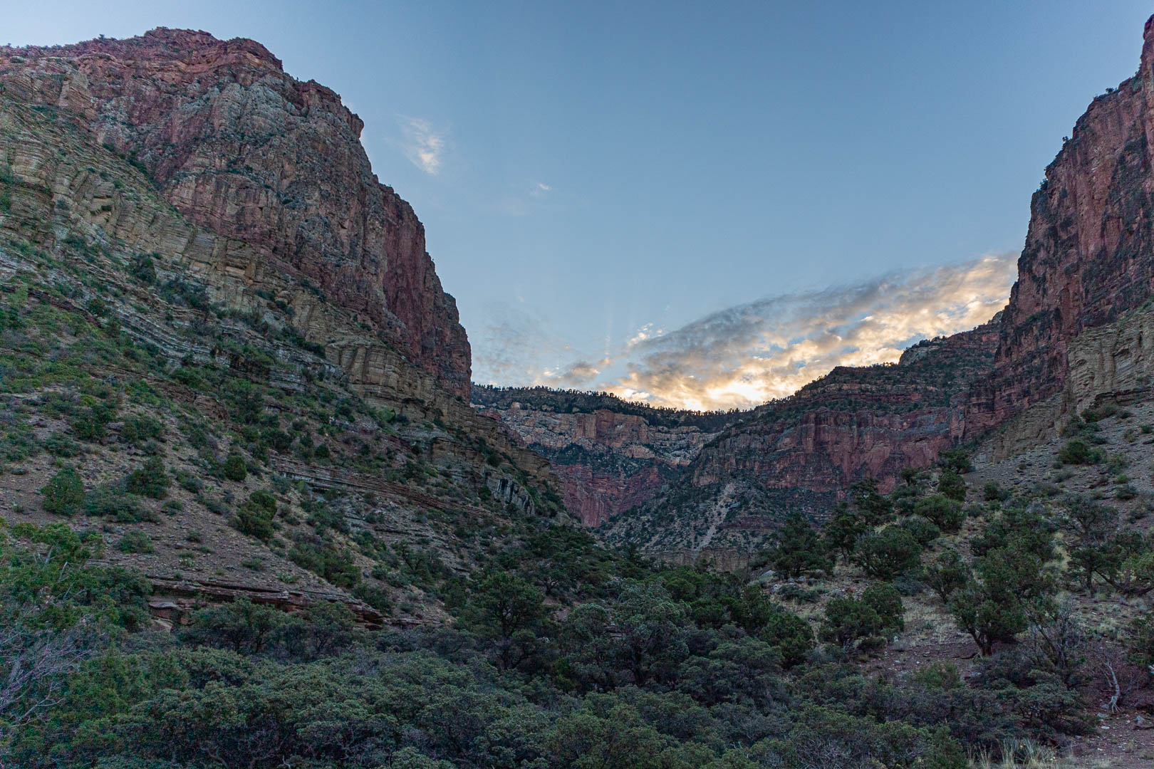
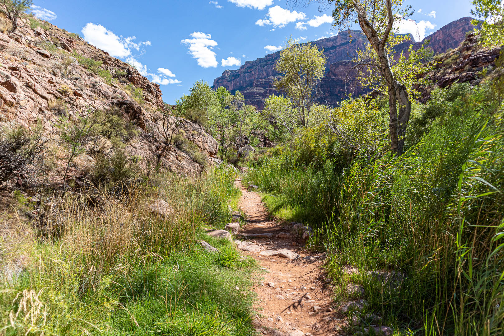
We reached the canyon floor just as the sun was rising – around 6:30 am. We were 3.5 hours into our trip and covered about 6.5 miles. From there, the trail levels off and you follow Bright Angel Creek all the way to the Colorado River, slowly descending at a moderate but steady grade. After short hike we arrived at the Pump House Ranger Station, where we took a much needed bathroom break and replenished our water.
Grand Canyon - Sunrise at Roaring Springs on the North Kaibab trail.
Grand Canyon - Sunrise on the North Kaibab trail during our rim 2 rim hike.
Grand Canyon - sunrise on canyon floor during our rim to rim hike.
Grand Canyon - our first view of the South Rim from the North Kaibab trail.
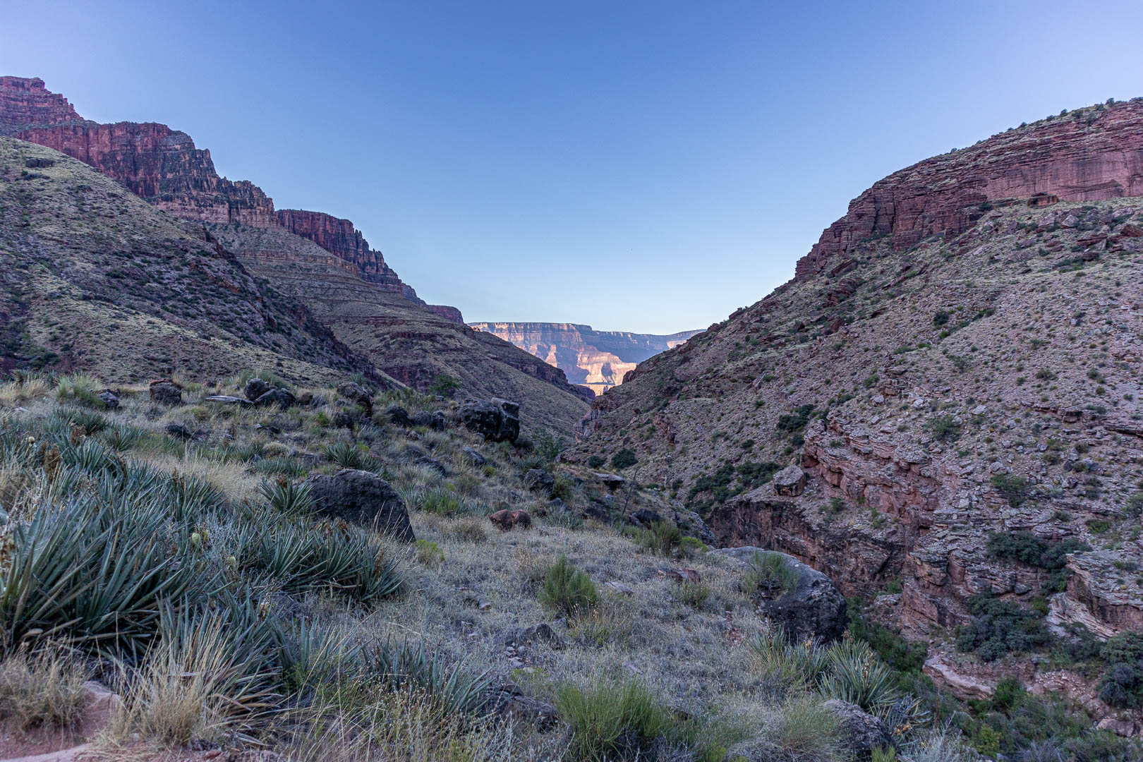
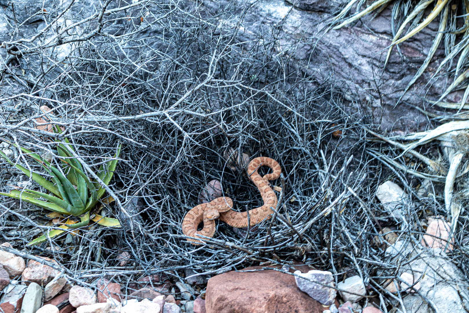
We pushed on, passing the Cottonwood Campground a short while later. Along the way, we encountered a pink rattlesnake just chilling in the brush mere feet from the trail. The pink rattler is a relative to the western diamondback and only found in the Grand Canyon. This rattler must have been used to hikers, because I was standing almost right over him, and he didn’t rattle or move at all. For the record, there was a large boulder just off the trail that separated me from him. I was leaning over the boulder and was in no danger of him being able to strike me.
Pink rattlesnake. The picture is a little blurry, I didn't want to tempt fate and stand over him too long.
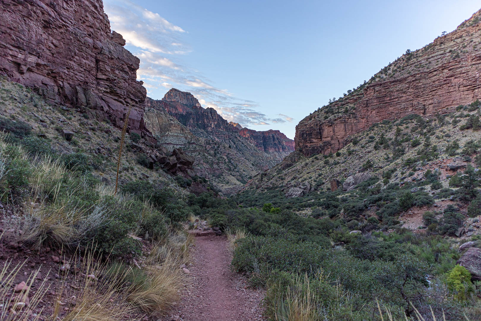
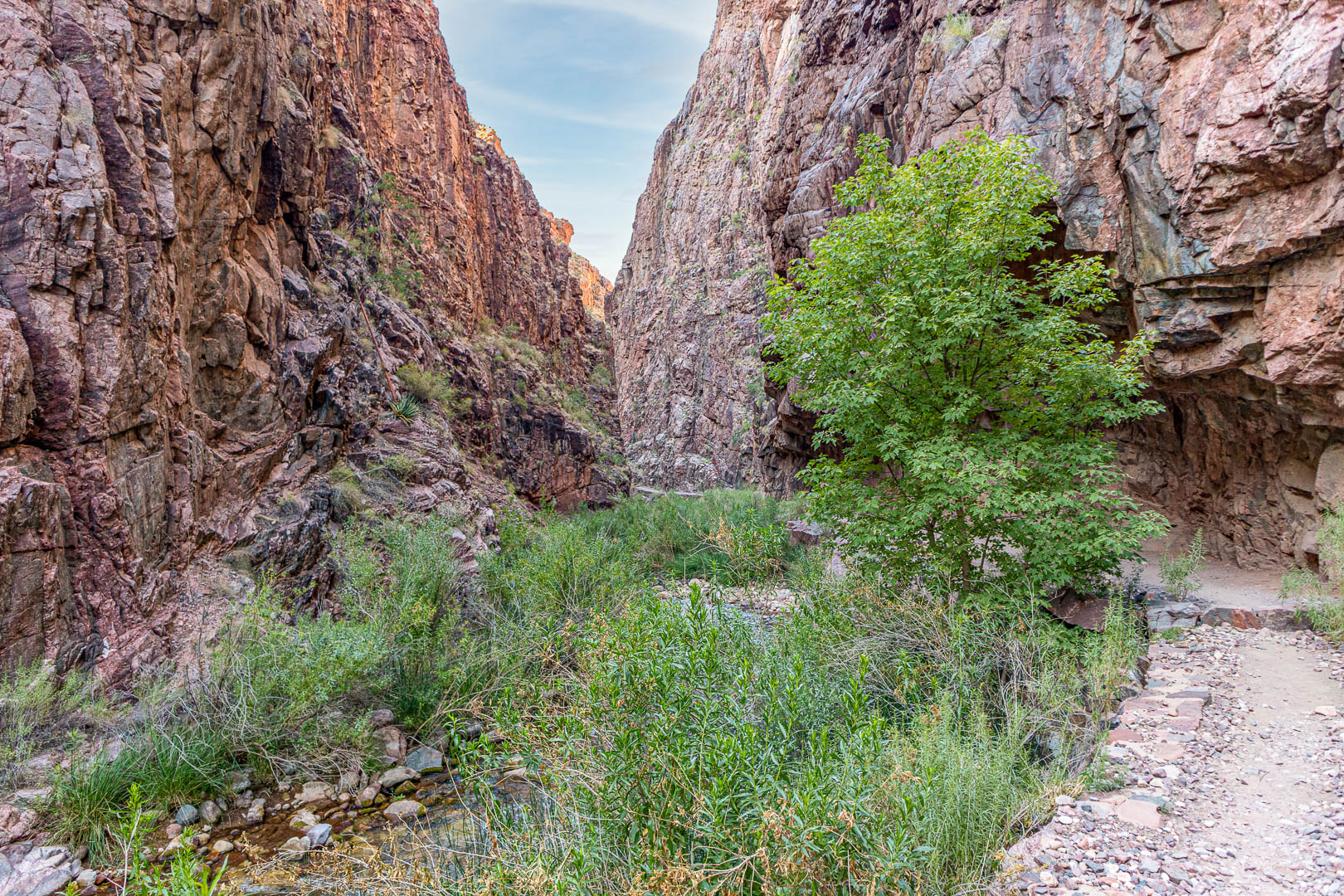
After another hour, we finally reached the start of “The Box”. It was 8:45 am, we’re making fantastic time thus far. The temperature was still below 100 degrees, so we made the correct decision leaving at 3 am. The canyon is very narrow in the box, which traps and radiates heat like a skillet. Since the canyon runs mostly north to south, the sun is always hitting one side of the canyon or the other during mid-day, reflecting the heat to the other wall, so it gets hot. Really hot…
The box is an interesting stretch – the canyon is very narrow and the Bright Angel Creek runs alongside the trail. Due to the narrow passage and the twists and turns, visibility is not great. All you see around you are steep walls, the creek, and some vegetation. You have no clue how far into the box you are, or where it ends. But after about 2 miles or so, you round a turn, the walls open up, and you enter Phantom Ranch. Ironically, it was at that point that we experienced peak temperatures. Just as we exited the box, we were hit by a blast of heat – it was 117 degrees at Phantom Ranch, at 10:55 am.
View of "The Box" in the Grand Canyon on the North Kaibab Trail.
I you’re not familiar with Phantom Ranch, it’s a historic oasis nestled at the bottom of Grand Canyon. It is on the north side of the Colorado River tucked in beside Bright Angel Creek. Phantom Ranch is the only lodging below the canyon rim, and can only be reached by mule, on foot, or by rafting the Colorado River. They have rustic cabins and a canteen that serves food and drink. I bought a cup of their overpriced mediocre lemonade, and it was the most amazing lemonade I’ve ever had!
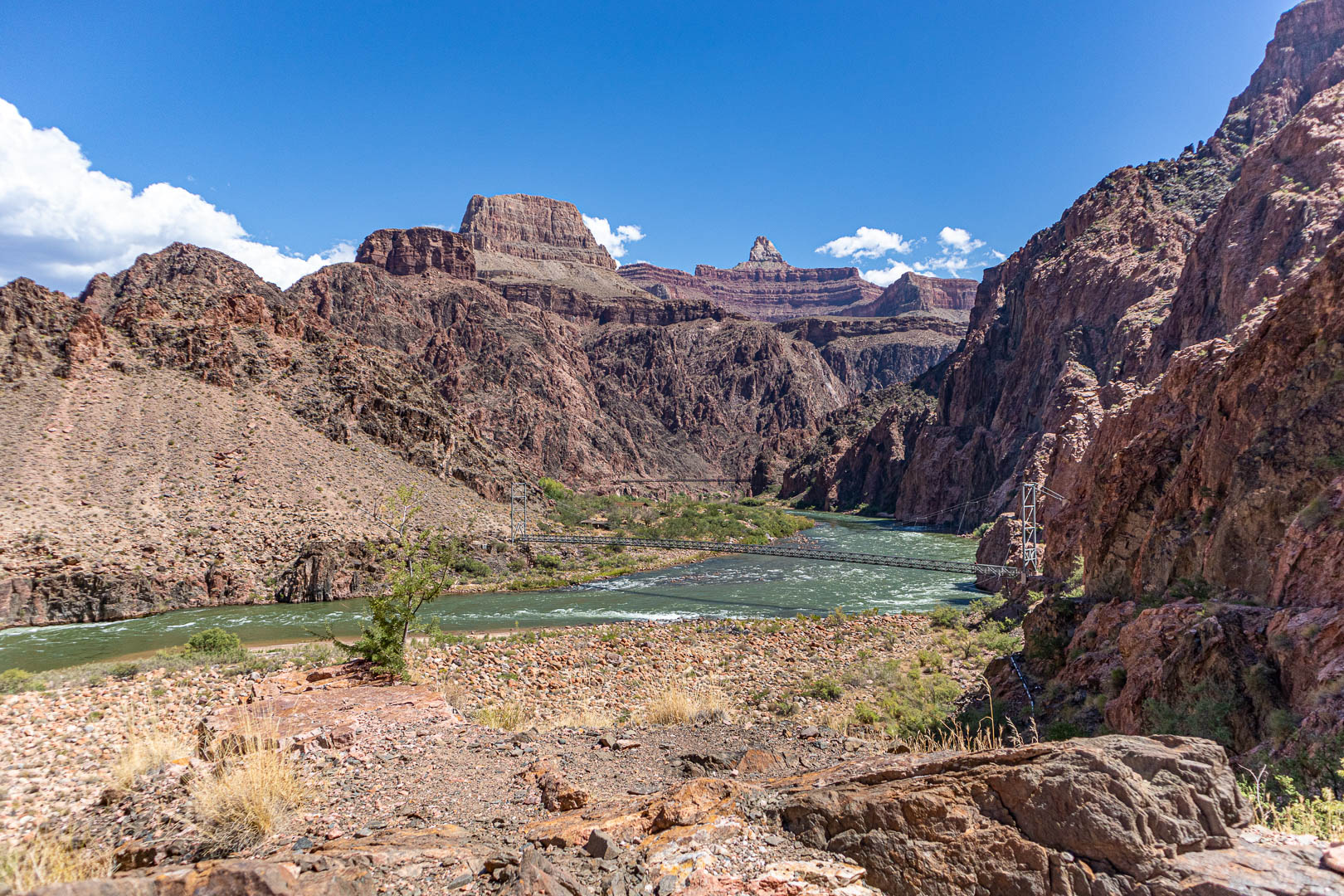
We rested at the Ranch for a while and then made our way to the Bright Angel Campground not far from Phantom Ranch. Abigail, Karley, and Jennifer stripped off their shoes and socks and sat in the Bright Angel Creek to cool off. An hour after exiting the box, right at noon, we geared up and headed to the Colorado River to start our ascent up the Bright Angel Trail. It was over 110 degrees and a good portion of our hike would be fully exposed to the sun. Little did we know, things were about to deteriorate…
Grand Canyon - view of the Colorado River and Black and Silver bridges during our rim to rim hike.
Grand Canyon - view of the Colorado River during our rim to rim hike.
The Bright Angel Trail
The hike from the campground to the river is about a quarter mile. We crossed the Colorado River on the silver bridge, stopping to take in its majesty. From there we follow the river bank for 1.2 miles, slowly working our way up a slight grade. This entire stretch is fully exposed with little shade. It was at this point that Karley started to feel the effects of heat and exhaustion. We were stopping for a brief rest every 10-15 minutes.
After about 45 minutes, we reached the Pipe River Rest House. We stopped for a brief rest and used the bathroom – the last until we reach Indian Gardens 3 miles ahead. We entered the slot canyon and hike 1 mile to the most colorfully named section of the trail, the dreaded Devil’s Corkscrew. We proceed slowly, taking frequent breaks to ensure we didn’t exhaust Karley or push her too hard.
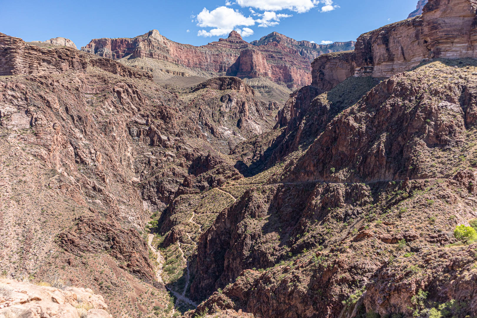
We reach the base of the Devil’s Corkscrew around 2:00 pm and start the climb. It’s only 3/10 of a mile, but a steep and treacherous climb. Karley is suffering and requires more frequent rests. It takes about 30 minutes to reach the top of the corkscrew, but we still have a steep half mile climb before we reach Garden Creek, which is a shaded slot canyon with vegetation and an indulgent respite of somewhat cooler temperatures. At this point, we’re extremely concerned Karley will collapse, so we decided that Abigail will immediately hike to Indian Gardens 2 miles ahead to seek help from a park ranger.
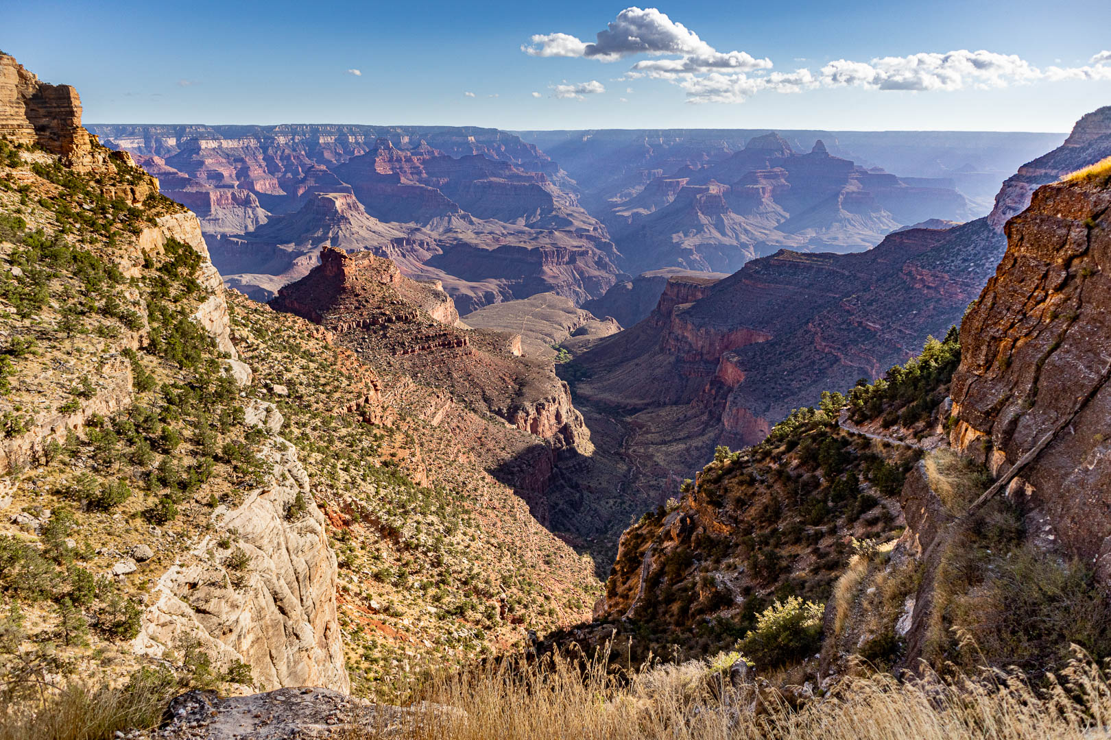
Grand Canyon - rim to rim hike along the Bright Angel trail. View of the Devils Corkscrew and the South Rim.
Grand Canyon - rim to rim hike along the Bright Angel trail. View from the top of the Devils Corkscrew looking to the north rim.
I stayed with Karley and Jennifer and we slowly made our way to Indian Gardens. When we were about 1/4 mile away, I rushed ahead to let Abigail know where we were. Karley and Jennifer arrived around 3:30 pm, and we directed the park ranger to Karley. The ranger advised Karley to rest and eat salty snacks and drink electrolytes. She felt we should stay the night in Indian Gardens, but we had hotel reservations that night, and no cell service to cancel them. We felt we could push on after a long rest.
Grand Canyon - rim to rim hike along the Bright Angel trail as we approach Indian Gardens
Things then took and odd and unexpected turn. The ranger (who was female) advised Karley and the rest of us to cool off in the creek. She said you don’t want your underwear to get wet or it would chafe, so she wanted us to soak in the creek naked. She even offered to join us (queue the 70’s porn music). We all found this very odd and graciously declined.
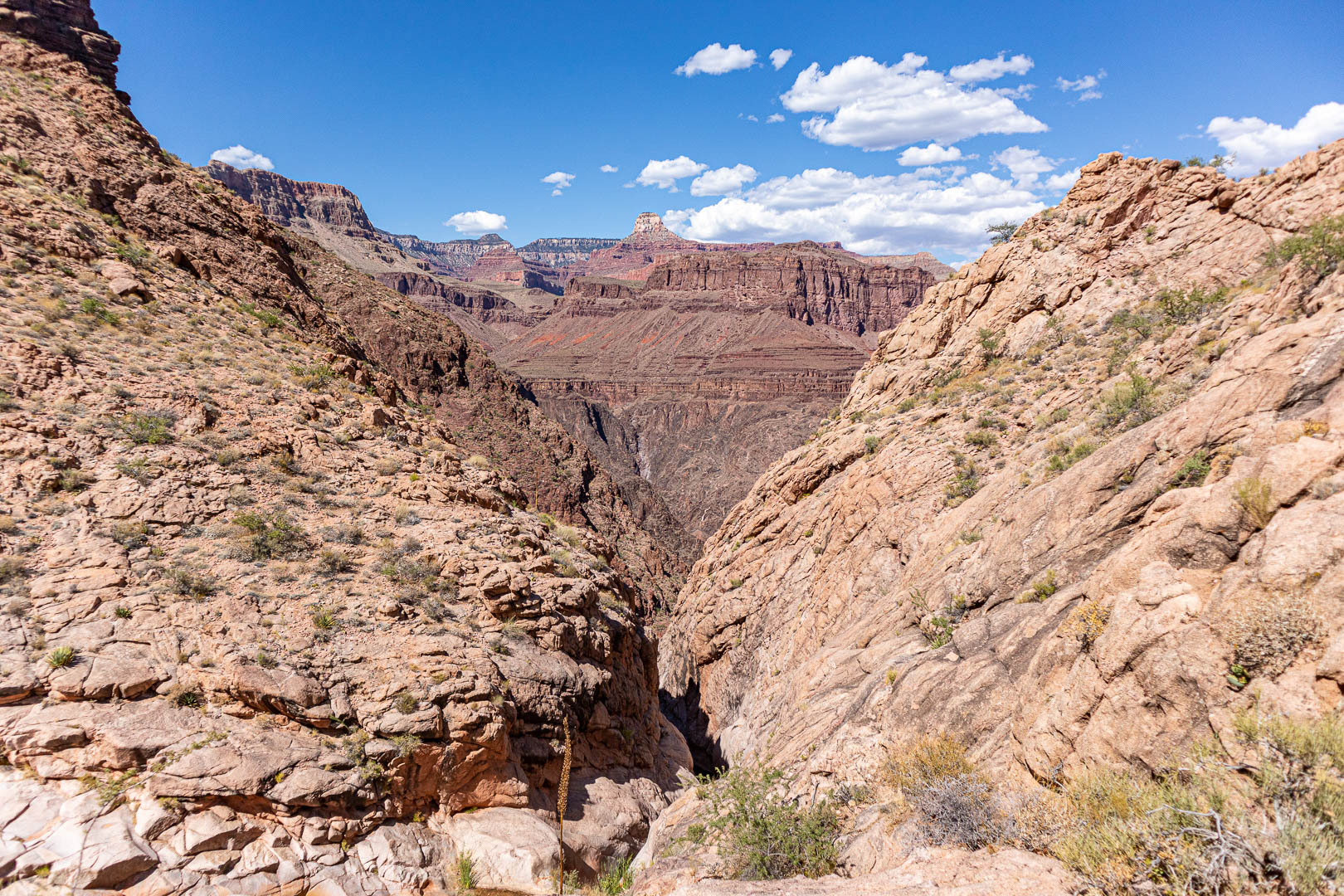
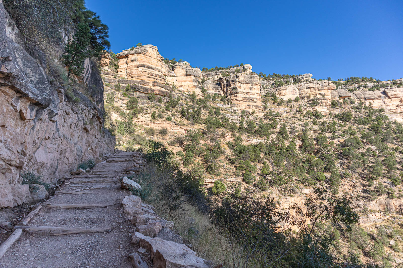
By now we’re 3 hours behind our intended schedule. We know we’ll be completing a good portion of the remaining 4.5 miles in the dark. There are 2 equally spaced rest houses along the way at 3 miles and 1.5 miles from the rim. We leave Indian Gardens right around 5 pm for our final push to the top. We mentally break the remaining hike into 3 parts – all we have to do is get to the 3 mile rest house. Then the 1.5 mile rest house. Then the rim. Easy, right?
Karley seemed to have rebounded somewhat after resting for 2 hours and replenishing much needed minerals and electrolytes. It’s slow going, and we’re still resting frequently. But after only an hour and 15 minutes, we reach the 3 mile rest house! We rest for about 15 minutes and set out again. The next stretch is a bit more strenuous than the last. The cruel thing about the Bright Angel Trail is that the closer you get to the top, the steeper the grade becomes. The sun is starting to set, so we put on our headlamps. Fortunately, it starts to drizzle a bit and the temperature has dropped now that darkness is setting in.
It’s now approaching 8 pm, we’re 1/8 of a mile from the 1.5 mile rest house, and Karley collapses on the trail. She feels nauseous and can’t move. Abigail and I rush ahead to the rest house to use the emergency phone to call for help. This was another odd experience. Since Abigail has a medical background, she’s on the phone with the park rangers. But we’re too far away from Karley and Jennifer for them to hear us. So I head down the trail so I’m half way in-between Abigail and Karley so I can relay the questions from the rangers. “When did you last pee?”, “what color was it?”, “have you experienced any diarrhea?”, etc.
Abigail and I returned to Karley and helped her hike to the rest house. The ranger was sending a search and rescue medic down to us. There is a metal locker next to the rest house with emergency supplies, and they gave us the combination to the lock. We found electrolyte tabs, bags of salty snacks, 3 sleeping pads, 2 sleeping bags, and emergency MREs. We grabbed them and made Karley as comfortable as possible.
The medic finally arrived around 10:30 pm – apparently he had several other people to tend to along the way. He drew blood from Karley and ran some field tests. She was diagnosed as hyponatremic (low sodium), which caused her body to shut down. She got an IV with a saline soluton and anti-nausea meds. They considered helicoptering her out, but she was looking OK after a few hours. It was past midnight and we decided that we need to wait until light to head out.
The medic was nice and brought us MREs to eat. It was a new experience for me, and it was 4,000 calories of deliciousness. I had pinto beans with ham, and I don’t think I’ve ever appreciated a meal with a 12 year shelf life as much as I did at that moment.
We finally settle in for some much needed sleep some time after midnight. The temperature was already below 50 degrees, with a low predicted around 40 that night. Abigail and I had not consider the idea of spending a cold night below the rim, so we were not prepared. There were only 2 sleeping bags, and Karley and Jennifer had them. Luckily, they had brought emergency Mylar blankets, and Abigail and I were able to stay warm that night. There’s nothing like an impromptu night spent sleeping on dirt in a crinkly Mylar blanket when it’s 40 degrees. Fun times.
We woke at about 5:30 the next morning as the sun was arching over the horizon. The view of the sunrise from the rest house was gorgeous. The ordeal from the night before was almost forgotten. Almost. We took in the amazing views, had a protein bar for breakfast, returned the emergency supplies to the locker, and started hiking the last 1.5 miles out of the canyon. It took us 2 hours, but by 8:30 am, we all arrived at the trailhead. We finally made it – 29.5 hours after we started. Together, as a group. It was definitely the hardest thing I’ve ever done, but we did it. I’d like to be upset over the ordeal, but I can’t. We all survived, made close friends, and have an amazing story to tell. As we approached the rim, I told Abigail I’d never hike into the canyon again, EVER. We’ve done it twice, and that’s enough. Don’t bother to ask, my answer is a resolute “hell no”. Exactly a year has passed, and Abigail and I are discussing the possibility of another rim to rim hike, but by ourselves this time. Maybe in 2022 or 2023, and absolutely in October or early November…
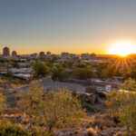
A gorgeous but hazy morning on the South Rim.
Approaching the Bright Angel trailhead - finally!
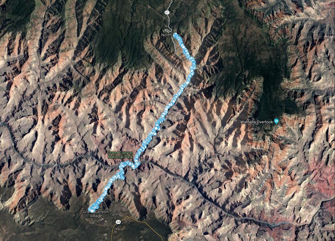
The GPS log of our Grand Canyon Rim to Rim hike from the North Kaibab trailhead to the Bright Angel trailhead.
A few months later in December, Abigail and I returned to the Grand Canyon to experience it covered in snow. We didn’t hike, we drove from spot to spot along the South Rim just to enjoy the views of the Canyon blanketed in snow. I was fortunate enough to get a snow covered picture of the 1.5 mile rest house from Maricopa Point. The small red sqaure in the picture below is where we spent the night. You can see how close we were to the rim!
The 1.5 mile rest house circled in red at the Grand Canyon along the Bright Angel Trail.
In the distance, you can see the San Fransisco Mountains in Flagstaff, the highest point in Arizona. We’ve discussed hiking up to Humphrey’s Peak, but I doubt we will. Wind gusts can be very strong, the trail is very rocky and rugged, and altitude sickness is common. No thanks! Plus, the Snowbowl has chair lifts that transport you up the ski slopes a short distance from the peak, so why hike it?